

Two-Way Data Integration Launched by OroraTech, TracPlus
Will Accelerate Wildfire Decision-Making On The Ground

Two-way data integration from aircraft and spacecraft for wildfire tracking has been announced by OroraTech and TracPlus. The insights, provided in real time will allow fire leaders to act with confidence when minutes matter. With the planet enduring worsening wildfires, including four of the five worst years for global forest fires occurring since 2020, the two wildfire technology leaders are joining forces to speed up on-the-ground decision-making.
“With TracPlus data alongside our wildfire situational awareness platform, responders don’t just see what the fire is doing; they see why.”
Dr. Martin Langer, OroraTech
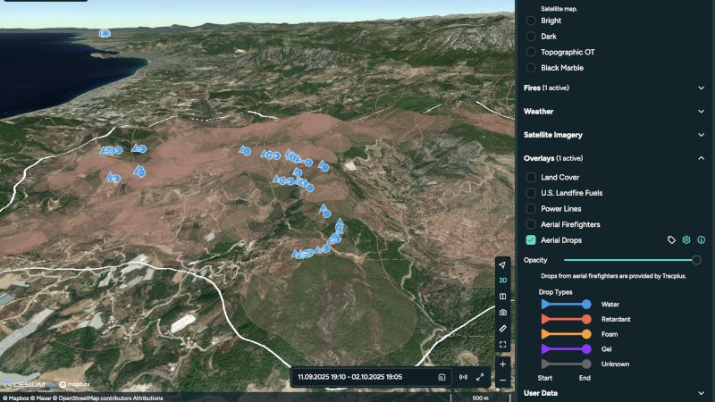
Under the partnership, TracPlus’ live aircraft tracking and drop event data will be available inside OroraTech’s Wildfire Solution platform, while OroraTech’s current fire perimeter intelligence will be visualized within the TracPlus platform. This first-of-its-kind linkage gives users of either system a shared operational picture of where the fire is and where drops have actually occurred, reducing delays and guesswork. Furthermore, TracPlus’ drop data will be integrated into OroraTech’s Fire Spread prediction modelling, allowing firefighters to see the impact of their efforts on fire behavior.
“Wildfires evolve by the minute. By pairing verified drop intelligence and live aircraft movement with OroraTech’s satellite-derived perimeters, incident leaders see two essential facts at once: where the fire is and where suppression has actually occurred, so they can direct the next action with confidence,” said John O’Hara, TracPlus CEO.
“With TracPlus data alongside our wildfire situational awareness platform, responders don’t just see what the fire is doing; they see why. Linking confirmed drops and air operations to real-time wildfire intelligence reveals how interventions are shaping fire behavior and supports faster, more confident decisions,” said Dr. Martin Langer, OroraTech CEO & CTO.
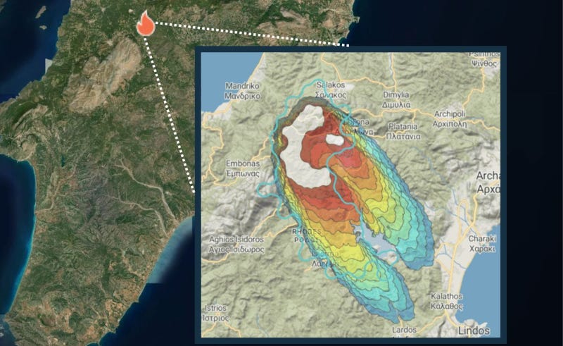
The integration plan provides one operational picture, linking live aircraft tracks and confirmed drops to up-to-the-minute perimeter intelligence for faster, aligned decisions at ICPs and in cockpits. This means a single source of wildfire information for on-ground and aerial firefighters.
It also offers:
Tasking with confidence: prioritize assets to the highest-impact sectors, validate effect, and reduce duplicate effort.
Faster debriefs: replace manual reconciliations with definitive post-mission evidence to inform next-event planning and long-term analysis.
Works where you work: customers can see the combined picture inside either platform, TracPlus or OroraTech, without changing their day-to-day workflow.
Initial capabilities will roll out to joint customers across priority regions in line with local fire seasons. Both companies remain committed to customer consent, secure data stewardship, and interoperability with agency systems.