

TerraMind AI Model Steps Up Earth Observation Analysis
Developed by ESA and IBM Research Europe

The first version of TerraMind, a powerful next-generation AI model designed to help us better understand and protect our planet, was released this week. The European Space Agency (ESA) has teamed up with IBM Research Europe to create TerraMind, an AI foundation model that explores large sets of data in a process called self-supervised learning.
"TerraMind is an AI model trained to understand our planet through satellite data, landforms and other key surface features."
Juan Bernabé-Moreno, IBM
By combining different types of data about our planet, it can deliver accurate answers to questions about climate and nature. From spotting methane leaks to tracking changes in forests and land use, TerraMind is set to play a key role in tackling some of the current environmental challenges.
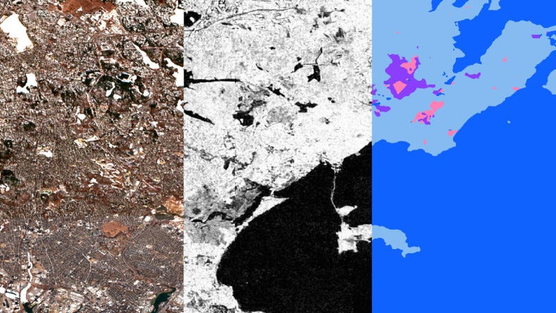
While some AI image-analytics models can be misled by ‘lookalikes’ – for example, shadows can be mistaken for landslides, or narrow roads can resemble rivers or water bodies – TerraMind is capable of analyzing Earth observation images with full awareness of the geospatial context, rather than merely examining individual pixel values.
TerraMind can handle many different types of data, a function known as ‘multimodality’, which will become increasingly useful as we collect more information about Earth. It incorporates data such as topography, land use/land cover, elevation and geolocation, in conjunction with satellite imagery, into its learning process. This model was trained using a dataset comprising more than nine million globally distributed samples, covering eight different data types, including radar from Copernicus Sentinel-1 and optical Sentinel-2 data.
Beyond its efficiency and accuracy, TerraMind has generative capabilities: it can create artificial data when inputs are missing – a common issue in remote sensing. With a novel approach called ‘Thinking-in-Modalities’, TerraMind can trigger a series of logical reasoning steps to solve a problem, while generating new data.
In a series of benchmark tests, TerraMind was found to be the best-performing AI foundation model for Earth observation. It also uses much less computing power – up to 10 times less than using separate models for each type of data.
This is a true ‘made-in-Europe’ tool: TerraMind was trained using the infrastructure and expertise of the Jülich Supercomputing Centre and has been fully developed by European researchers and engineers.
“Developed by IBM Research and ESA, TerraMind is an AI model trained to understand our planet through satellite data, landforms and other key surface features. Rather than just analyzing images, it builds a deeper, more intuitive understanding of Earth’s systems,” said Juan Bernabé-Moreno, Director of IBM Research (UK and Ireland) and IBM's Accelerated Discovery Lead for Climate and Sustainability.
“TerraMind can understand satellite images in a smart, powerful way, making it great for tracking large-scale events on Earth. It is trained on lots of data and built with novel technology that helps it to see the big picture,” highlighted Nicolas Longépé, Earth Observation Data Scientist at ESA’s Φ-lab and TerraMind’s Technical Officer.
Released on Earth Day, the first version of TerraMind includes models and all the necessary scripts to run them, available here. There is an opportunity to learn more about TerraMind at the upcoming ESA-NASA International Workshop on AI Foundation Models for EO, from 5 to 7 May 2025, at ESA-ESRIN (Frascati, Italy).