

Satellites are Vital when Making Emergency Preparations
Spacecraft are Not Affected by Terrestrial Weather

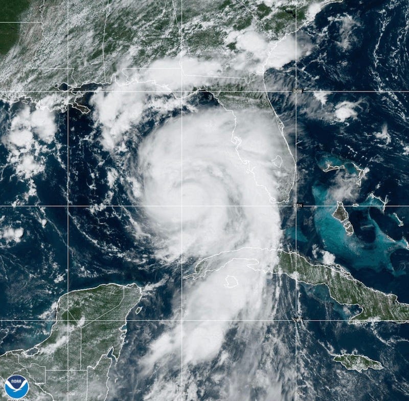
With the peak of the Atlantic hurricane season arriving September 10th, the Satellite Industry Association (SIA) today encouraged policy and lawmakers to consider the vital role satellites play in providing communications and other important services following a natural disaster. Because satellite networks operate far above the Earth’s surface, they are not vulnerable to damage by storms or other weather-related emergencies such as wildfires. Therefore, satellite communications may often be the only way government and emergency first responders can communicate, track critical emergency assets and access valuable post-disaster imagery and data networks if terrestrial infrastructure is damaged or services are unavailable.
"Many satellite companies already have long standing relationships with local, State and Federal government organizations both here in the United States and around the globe."
Tom Stroup, SIA
“With NOAA now forecasting an above normal Atlantic hurricane season and the recent wildfire emergencies in Maui and Washington State, it is vital for government relief agencies, private enterprise and even consumers to consider the unparalleled level of reliability and ubiquity of satellite services when planning for natural disasters,” said Tom Stroup, president of the Satellite Industry Association. "Because of this reliability, many satellite companies already have long standing relationships with local, State and Federal government organizations both here in the United States and around the globe. These relationships help to ensure that first responders and relief agencies have access to vital communications and information wherever and whenever they are needed.”
The availability of reliable satellite voice and data communications for relief agencies and first responders following a natural disaster is already well documented. Satellite Earth observation and remote sensing has greatly expanded in the past five years and these services have enhanced both forecasting and post hurricane/disaster relief. Optical imagery has long been available for forecasters and meteorologists as well as emergency responders for visual reference before and after disasters. Today, thanks to new technological innovations, smaller remote sensing and imaging satellites are capturing optical, synthetic aperture radar (SAR), radio occultation (RO) and other multispectral data from space. The use of “before and after” imagery and remote sensing data has also become a key part to disaster response. Organizations and government agencies use that data to help ensure response decisions can be made with efficiency and confidence, giving first responders on the ground further information about what areas require prioritization.
The SIA has prepared a document outlining the critical role satellites play before and after a weather disaster such as a hurricane.