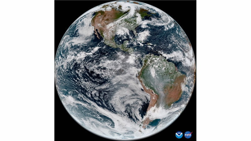
First GOES-19 Image Captured
L3Harris Advanced Weather Imager is Aboard NOAA's Latest Satellite
The Advanced Baseline Imager (ABI) onboard NOAA’s newest weather satellite captured its first image since launching into space in late June, representing a significant milestone prior to reaching full operational status. The new, full disk GeoColor image was captured Aug. 30, 2024.
“Since its first launch in 2016, our ABI has been providing NOAA meteorologists with world-class imaging capabilities."
Ed Zoiss, L3Harris
The L3Harris ABI is the primary instrument for NOAA’s Geostationary Operational Environmental Satellite-19 (GOES-19), the fourth and final satellite in the GOES-R Series. ABI’s high-resolution imaging technology provides the ability to rapidly and accurately detect and track hazards including severe thunderstorms, wildfires and hurricanes.
“Since its first launch in 2016, our ABI has been providing NOAA meteorologists with world-class imaging capabilities enabling warning of hazardous weather systems across the entire Western Hemisphere,” said Ed Zoiss, president, Space and Airborne Systems, L3Harris. “As we celebrate this milestone, L3Harris remains committed to supporting ABI on-orbit and future NOAA programs that will provide critical, real-time weather data to citizens for decades to come.”
GOES-19 is part of a global ring of satellites that includes seven L3Harris ABI-class instruments – four for NOAA, two for Japan and one for South Korea. L3Harris is also developing the Geostationary Extended Observations (GeoXO) Imager (GXI), NOAA’s next-generation geostationary imager that will advance human understanding of environmental threats with more precise observations of the environment beginning in 2032 and operating into the 2050s. The company is also providing a GXI-class Imager and an L3Harris-developed sounder instrument for Japan’s next-generation Himawari-10 mission.