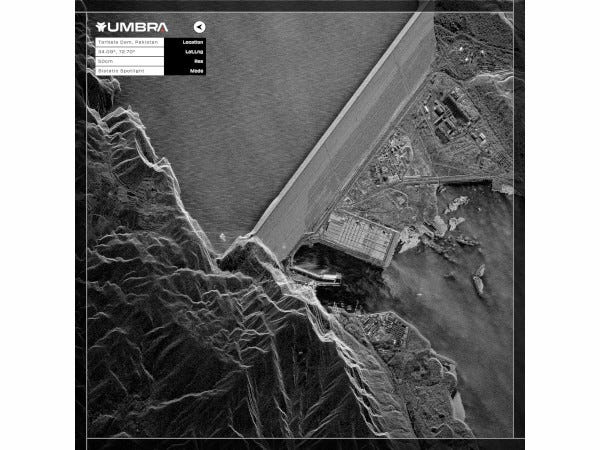
Imagery from a tandem pair of Synthetic Aperture Radar (SAR) satellites has been released by Umbra. The company is set to provide customers with bistatic SAR data later in 2024.
"The ability to operate spacecraft in coherent pairs is an important step in unlocking the novel promises of cluster operations."
Jason Mallare, Umbra
The launch of Umbra's first tandem pair of satellites, Umbra-07 and Umbra-08, aboard the SpaceX Transporter-9 mission last November, marked a significant leap in SAR imaging, according to the company. With eight satellites currently in orbit, Umbra plans to deploy the remaining satellites in its licensed 32-satellite constellation in strategically designed pairs.
Operating satellites in a cluster formation facilitates multistatic collection and other integrated operations, offering distinctive phenomenology and inherent resilience. This innovative approach opens the door to various applications, including Intelligence Surveillance Recognizance (ISR) capability, elevation modeling, imaging resilience, and the implementation of moving target indication techniques.
"The ability to operate spacecraft in coherent pairs is an important step in unlocking the novel promises of cluster operations," said Jason Mallare, vice president, Global Solutions. "The scaling up from one to many, with highly affordable individual satellites, enables clustered flight with the potential for proliferation of truly resilient systems that offer tremendous traditional and full spectrum capabilities."
Umbra's development of the technology necessary to automate formation flying and multistatic data processing has been dramatically accelerated by the Defense Advanced Research Projects Agency (DARPA) over the past year, which selected the company as a partner for its Distributed Radar Image Formation Technology program.
With the unique ability to capture images at day/night, all-weather capable, Umbra's SAR satellites are indispensable for monitoring change. Umbra's high-performance SAR satellites deliver the highest quality SAR data at unprecedented volumes and area density, enabling the US. Government, its allies, and commercial partners with actionable, all-weather insights.