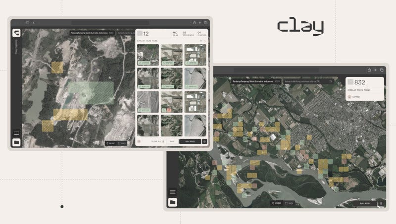
A nonprofit AI startup unveiled new products at several events this week as part of an effort to catalyze a hundredfold increase in the use of Earth observation — the collection, analysis, and use of data to better understand the planet.
"The Clay app makes it far easier for the development sector, as well as all those working on climate and nature, to build powerful new geospatial tools."
Bruno Sanchez-Andrade Nuño, Clay
The company is called Clay. The Clay system is like ChatGPT but for satellite data in that it is rooted in a general purpose, AI-powered model. The flexible system is designed to efficiently and effectively make use of satellite data, with prospects for users to tailor the platform by adding their own data, executing their own analytics, building their own apps, doing natural language search, and more.
A new report from the World Economic Forum estimates that by 2030, AI-fueled growth in the Earth observation field could reduce global emissions by approximately 5%. Clay's new products, which are scheduled for a June release, make Earth observation better, faster, cheaper, more sustainable, and more accessible.
The Clay Model, which the company says is the world's biggest, fastest AI foundation model of satellite data and other information about Earth's features, is trained on freely available data. Clay's open-source model can generate outputs that can stand alone or be used to create ingredients in proprietary workflows, including via an API and Jupyter AI integration.
The Clay App is a no-code app that enables inexpensive, fast, and easy Earth analytics using Clay's model outputs, the company says. The user experience is designed for nontechnical users to map, monitor, analyze, or report on anything Earth-related — harnessing the power of Earth observation using point-and-click or chat, without needing to touch a line of code.
Clay also announced the AI for Earth Challenge. Co-sponsored by several leading organizations in the field, the challenge creates a benchmark to reward AI satellite models with operational excellence and accelerate progress in the field by focusing effort and resources on the best solutions.
"The Clay app makes it far easier for the development sector, as well as all those working on climate and nature, to build powerful new geospatial tools," said Clay Co-Founder and Executive Director Bruno Sanchez-Andrade Nuño.
"AI-powered Earth analytics is already mind-blowingly cheaper, faster, and more powerful than the current standard," said Dan Hammer, co-founder of Clay. "It's going to change the field and planet."
With proof of concept in hand, Clay will now transition to tools and programs to scale up collaborative development and use in the field.